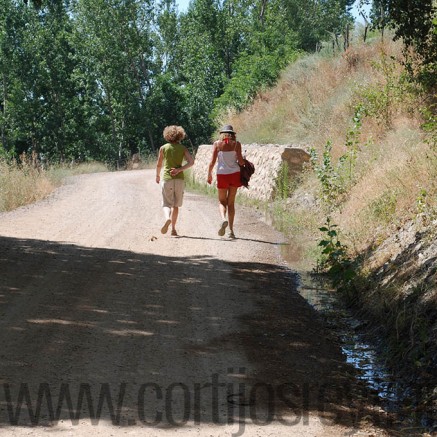
For both of these walks you need to firstly drive to Trevelez and park your car in the middle or barrio medio. You need to walk past a furniture workshop/shop on your left and the Church on your right then you will see a sign saying Camino Molino just a short way up the hill on your left. Take the path forward which continues towards the river. This part of the walk is flat and very pretty. Continue until you reach the bridge which you need to cross to the other side.
- Camino Molino – to the bridge
- Penabon
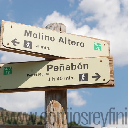
- After passing the bridge you will see a large building on your left which is the common stables for Winter use. Just beyond this you will find 2 paths, one to the left which keeps the river to your left as you walk and the other straight ahead to a fenced off cortijo. Both ways are signed Camino Penabon, approximately 1 hour 40 minutes. One thing about these signs is you should take them with a pinch of salt, as none of them are accurate and of course timing depends on your own walking speed. If you are fit and have several hours it is possible to make a loop going one way and returning the other, so that you walk a full circle.
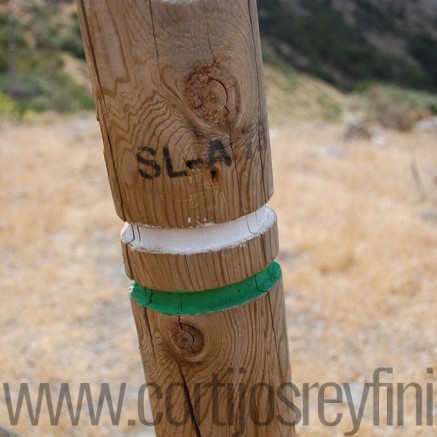
- Alternatively take the left hand sign following the river and go as far as you wish, passing several cortijos and several places to drink fresh mountain water. However, if you decide to make the loop as a continuation of this walk, go for approximately 40 minutes until you see a post with green and white painted stripes signposted to Penabon. What is important to remember is that these sticks can be confusing and could take you along other paths. It is important to realise that when you see a white and green sign forming a cross this means this is not the way to go. You can still walk this way but it will go elsewhere, so as much as possible always stick to the signs with white and green stripes and not a cross. If you follow this road it climbs up and up and gets harder for about half an hour, then the path
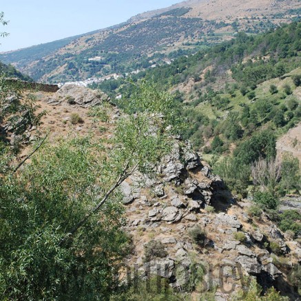
will continue to the peaks above Trevelez Mountain called Penabon.
When you get to the peaks you will have to carry on for a while until you find a path downwards which is badly signposted through the forest and back to the bridge where you began your walk. If you want to take the whole loop we would suggest you start from the beginning and go straight up for about 100 yards and then turn right crossing the river and find the path again the other side and go upwards, straight up for about half an hour until eventually almost on the top of the mountain you will reach the path. If you turn left here then it will bring you eventually to the path along the river and then you can return this way. Going this way the possibility of getting lost is much less. If you are walking with young children we recommend the route along the river and not the other one. There is plenty of drinking water this way but this becomes scarcer the higher you go.
For more adventurous hikers you can go along the river until you pass the third cortijo and you will see the path going uphill which is also signposted with green and white SL-A towards Penabon. After about 100 yards you will find a crossing where the path splits into 2 – one goes straight on which is the loop walk, and one to the left with a cross on top of the post – if you take this route it will take you up to the peaks passing several drinking water springs and eventually you will cross the mountain to the other side.
Please always check the weather forecast before you leave for a walk.